I'm not a Star Trek writer, I'm a science fiction writer. I like building my own worlds more than share-cropping in someone else's.
— David Gerrold, well known science fiction author who has contributed to Star Trek (e.g. wrote "The Trouble with Tribbles" episode).
Introduction

Figure 1: Mendenhall Glacier (Photograph by Me).
My wife and I are currently on an Alaskan cruise with friends that used to be our neighbors when our children were young. Our cruise ship is the Millennium, which is part of the Celebrity fleet. We are currently moored in Juneau, where we visited the Mendenhall glacier. While at the glacier, I talked with a local Forest Service guide about the rate of glacier melting. I also made a few measurements using my phone and a bit of math then ensued, which I will discuss here.

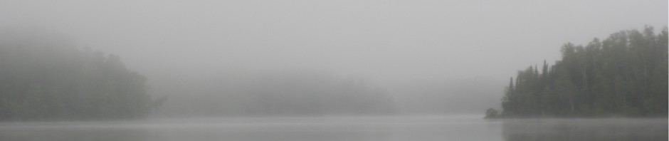
Figure 2: Nugget Falls (Photograph by Me).
I will be estimating the amount of glacial runoff that was occurring today and will estimate the total contribution of the glacial runoff to the flow of the Mendenhall River. Much of the glacial meltwater enters the Mendenhall River by way of Nugget Falls (Figure 2). I will estimate the contribution of glacial meltwater to the flow of the Mendenhall River by estimating the flow from Nugget Falls – I assume that all other glacial sources into the Mendenhall River are ignorable. I obtained the daily flow of the Mendenhall River from a Forest Service guide.
As usual, my calculations are rough, but do give a feel for the amount of melting that is occurring. After I performed my calculations, I found a peer-reviewed journal article that presents similar data. I have included this article with this post.
Background
Basic Information
Here is what I learned from the Forest Service guide:
- The Mendenhall River carries about 10 billion (x109) gallons of water every day from the Mendenhall glacier region (source: Forest Service guide).
- Approximately 200 feet of glacier is melting away each year (source: Forest Service guide). I will not use this value in my calculations, but I record it here as being an interesting number.
- Approximately 50% of the Mendenhall River flow is made up of melt water from the glacier during the peak of summer heat (source: peer-reviewed paper). I have included the abstract from this paper here.
- Mendenhall Lake has not been there all that long. The Wikipedia states that it first formed in 1958 (source: Wikipedia). Note that some sources say it started forming in the 1930s – still not that long ago relative to the age of the glacier.

Figure 3: Mendenhall Glacier's Retreat versus Time (source).
Figure 3 provides the best illustration that I could find of the extent and rate of the Mendenhall glacier's retreat. You can see that the rate of retreat is accelerating. For example, the amount of retreat from 1760 to 1832 is about equal to that from 1982 to 1996. In 2004, it retreated 200 m (656 feet).
A number of Alaska's glaciers are retreating – there are about 100,000 glaciers in Alaska (source). This could have long-term implications for a number of Alaskan cities that depend on the glacial meltwater for their freshwater supply.
Measurements
I have a couple of applications on my phone that helped me make a few measurements:
- Mil Rangefinder: This application allows you to use your phone estimate the size of something given its distance from you or vice versa. With respect to Nugget Falls, I will use this app to measure the width of the falls.
- Clinometer: This application allows you to measure the angle of an object. Given the inclination of an object and its distance from you, just a bit of trigonometry will give you its height. I will use this app to measure the height on the falls that I can use to measure the time of fall of water from an elevated point to Mendenhall Lake.
- Stopwatch and Timer: I used this to estimate the time it took the water to fall a given distance.
Analysis
Figure 4 shows how I generated my estimate for the Nugget Falls flow rate and its contribution to the flow of the Mendenhall River. My results are consistent with one published estimate for the Nugget Falls flow rate – I could not find any other flow rate estimates.

Figure 4: Estimate of Nugget Falls Flow Rate.
Conclusion
My estimate for the flow of water from Nugget Falls is in the same range as an estimate given in a peer-reviewed journal article. Generating my flow rate estimate proved to be a good test of my phone's distance and size measuring applications.
These apps are not complicated, and I will blog about how some of them work in posts to follow.
Appendix A: Quote on Glacial Melt Percentage in Mendenhall River
The abstract from this peer-reviewed paper gave me a rough number for the glacial melt percentage of the Mendenhall River.
Mendenhall Glacier is a dynamic maritime glacier in southeast Alaska that is undergoing substantial recession and thinning. The terminus has retreated 3 km during the 20th century and the lower part of the glacier has thinned 200 m or more since 1909. Glacier-wide volume loss between 1948 and 2000 is estimated at 5.5 km3. Wastage has been the strongest in the glacier’s lower reaches, but the glacier has also thinned at higher elevations. The shrinkage of Mendenhall Glacier appears to be due primarily to surface melting and secondarily to lake calving. The change in the average rate of thinning on the lower glacier, >1 m a-1 [annum] between 1948 and 1982 and >2 m a-1 since 1982, agrees qualitatively with observed warming trends in the region. Mean annual temperatures in Juneau decreased slightly from 1947 to 1976; they then began to increase, leading to an overall warming of ~1.6 °C since 1943. Lake calving losses have periodically been a small but significant fraction of glacier ablation. The portion of the terminus that ends in the lake is becoming increasingly vulnerable to calving because of a deep pro-glacial lake basin. If current climatic trends persist, the glacier will continue to shrink and the terminus will recede onto land at a position about 500 m inland within one to two decades. The glacier and the meltwaters that flow from it are integral components of the Mendenhall Valley hydrologic system. Approximately 13% of the recent average annual discharge of the Mendenhall River is attributable to glacier shrinkage. Glacier melt contributes 50% of the total river discharge in summer.
Pingback: Samsung S5 Field of View | Math Encounters Blog
Pingback: Dealing with Climate Change Denial | Math Encounters Blog